It’s no secret that swings are having a moment today. Look anywhere on Instagram and you’ll see beautiful swings in faraway locations: Bali, Ecuador, Norway…and the list goes on! But we also have some beautiful swings in California that are worth traveling for, not the least of which is Serenity Swing in San Luis Obispo.
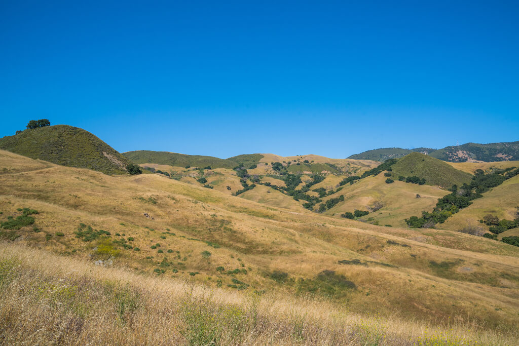
The Serenity Swing hike is an excellent hike to take because you’re in beautiful central California, the weather is great, and the rolling hills are gorgeous. It’s also an excellent hike because at the end you’re rewarded with stunning views and the perfect swing in the shade of an old oak tree! So if you want to know about this hike and how you too can experience it, then you’ve come to the right place.
Looking for more things to do in San Luis Obispo? Find lots of amazing ideas here!
The Serenity Swing Hike Experience
One of the things I love most about San Luis Obispo is all the outdoor adventures and hikes, and the Serenity Swing hike has long been one of my favorites. I used to love going up here during my days studying at Cal Poly!
If you’re a student at Cal Poly, this hike should certainly be on your list of things to do…after all, it is on your campus and is only accessible from Cal Poly! It’s a little easier to visit when you’re a student because you probably already have a parking pass (or maybe even live on campus) which means you can just walk to the trailhead. If you don’t study or teach at Cal Poly, then you will have to pay to park or take public transport to here…but never fear: this hike is worth it!
At around 3.5 miles from the trailhead (more like 4 miles if you’re coming from a parking lot nearby), this hike will treat you to beautiful views along the way as well as stunning wild flowers during some parts of the year.
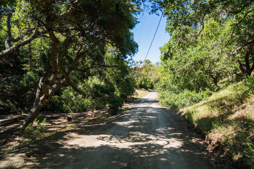
To begin your hike, you will spend some time walking along a wide, paved path called Poly Canyon Road. It is blocked off for most cars, but it can be a pretty popular trail for runners and bikers so you may run into quite a few people here from time to time. If you would rather take a different trail during this part of the hike, you could also use the Brizzolara Creek Trail which runs parallel to Poly Canyon Road instead.
As you walk along this trail, you’ll eventually make your way to the Architecture Graveyard (which is a fun place to visit and was once the “experimental practice laboratory” of former architecture students at the university). If you have the time, you can take a short detour and explore the area and see all the unique structures!
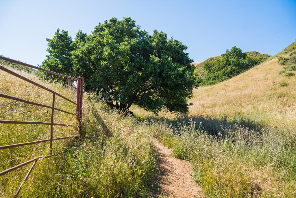
If you want to just continue on the Serenity Swing trail, however, you’ll continue on past the “Experimental Practice Laboratory” sign and take the trail off to the right along the fence as shown in the picture below.
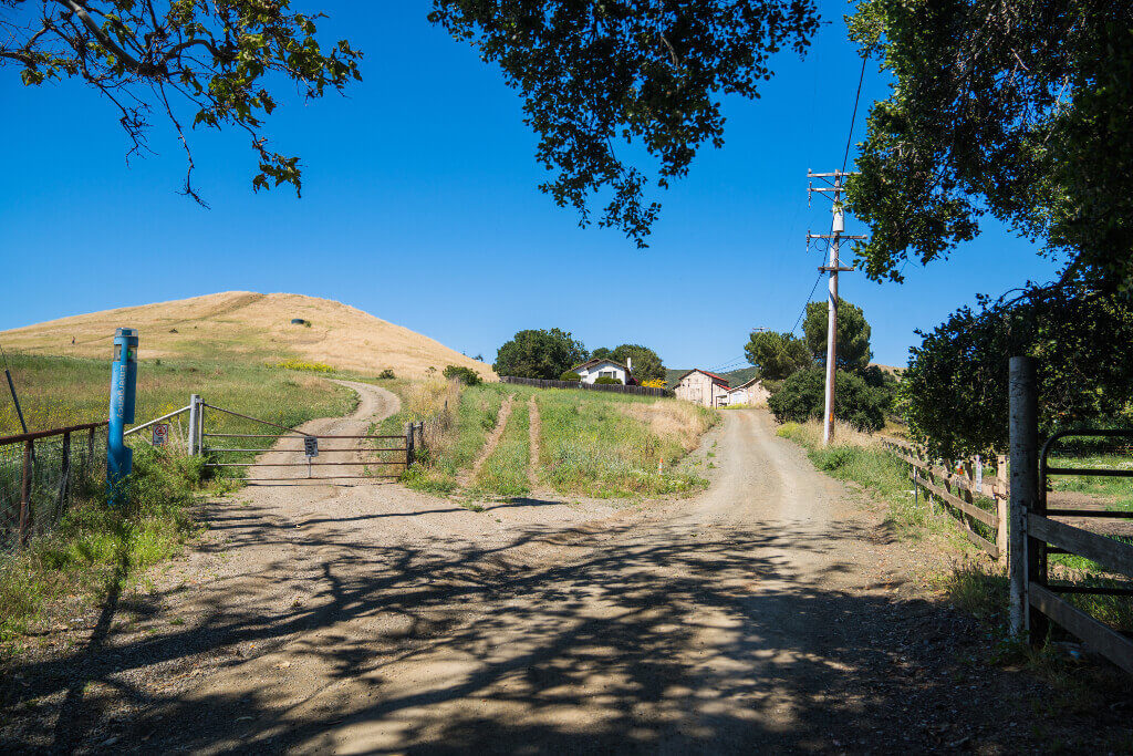
Very soon you’ll come up on a set of houses (where some Cal Poly students in agriculture-related majors usually live), but while it may feel like you’re intruding on someone’s home this is actually a legitimate part of the trail!
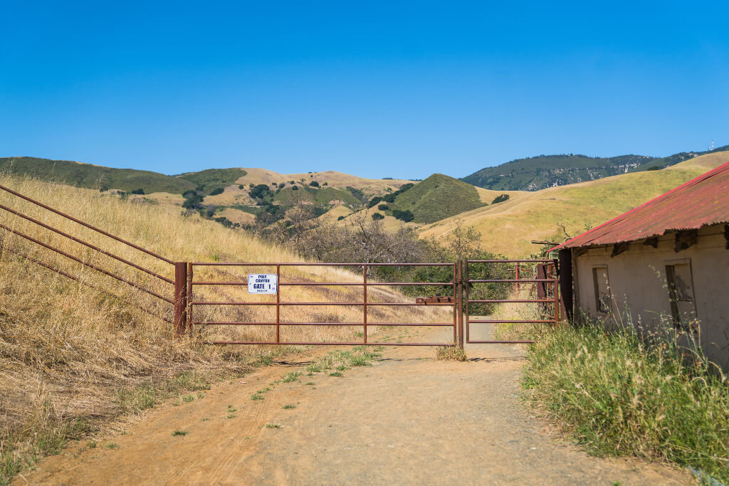
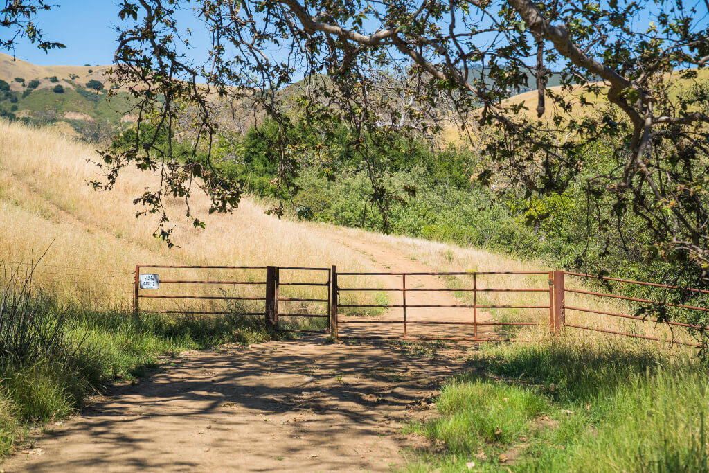
Just past the houses you will see a gate marked “Poly Canyon Gate 1.” There’s a walking gate with a chain draped over it to keep it closed, but you simply walk up and remove the chain, walk through, and then replace the chain once you’re on the other side. Please remember to close the gate behind you!
Walking down the trail past the gate will soon lead you to another gate, predictably marked “Poly Canyon Gate 2.” You will need to open this one the same way and go through it to continue on the Serenity Swing Hike.
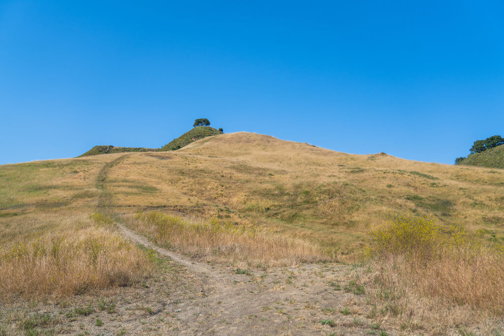
You’ll continue along following the trail (it’s easiest to know where you’re going if you use a map like the one I’ve put later on in this post to help you find your way). Occasionally there are some social trails that branch off, but you’ll want to continue along the wide trails until you run into a small trail that looks like the one below. While at first it looks like a social trail, this is actually the most “official” trail option to get to the top.
As you follow this new, narrower route you will soon come to a dip in the trail where there is an unmarked gate ahead. Walk through this gate just like you did with the others and then make an immediate left to follow the trail. You’re nearly there!
While the trail has been mostly easy and fairly flat/gently sloping up to this point, this is where things get pretty steep and a little difficult. I remember hiking here one time in the spring and running into a group of three others at this part and one of them just flat out refused to continue at this point! It can get a bit muddy/slippery after the rain, too, so that’s something to consider and be aware of before you decide to come here if it’s been raining.
At the point where it turns steep, you’ll have two trail options. I recommend you take the trail to the right as it is slightly easier to keep your footing. (I once foolhardily chose the path to the left and regretted it, but then turned around and realized it was worse to try to get back down without slipping than it was to try to keep going up without slipping. A terrible mistake!). You’ll need good shoes with good grip and a little persistence if you aren’t used to climbing steep areas like this, but the good news is that it is a super short section of the hike so it will be over quickly!
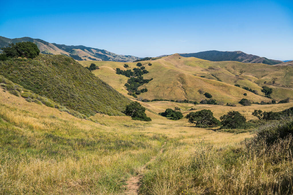
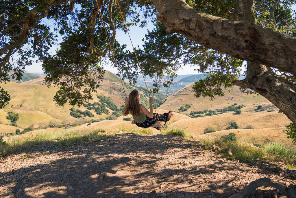
And once you make it to the top? Well, it sure is worth it! Getting to feel the cool breeze, look out over the gorgeous hills, and swing to your heart’s content is one of the best feelings in the world!
Be sure to leave time to enjoy swinging up here (and leave extra time on weekends/holidays in case there are already people at the top and you have to wait to swing). And once you’re done? Well, the hike is a lot easier going down. Just head back the way you came…but know that you’ll want to come back to this perfect little spot again and again in the future. Because it really does live up to its name: you’ll feel like you actually have found serenity and peace up here at Serenity Swing!
Serenity Swing Trail Map
Use this map to help you navigate to Serenity Swing! On the map you’ll see the Serenity Swing trailhead at Poly Canyon Road, as well as the actual location of the swing. And the directions show you the best path to take to get to the top of the hill and find the swing!
How to Visit Serenity Swing
Here are a few things you should know to help you visit Serenity Swing and have a fantastic time!
How to Get to Serenity Swing at Cal Poly?
Serenity Swing is on the California Polytechnic State University campus, so you’ll need to visit the university to start your hike. You can use the map I created to help you navigate, follow my step-by-step instructions in the post above, try putting it into Google Maps on your own to see the possible routes, or just wing it and see where you end up (hopefully at the swing, and then even more hopefully back home safe and sound afterward).
Where to Park to Hike Serenity Swing?
If you’re driving to Cal Poly to hike Serenity Swing and don’t have a permit for campus, then you can park in one of the metered spots or buy a pass for a short time. If you’re curious, you can see where I parked last time I went on the map above or through this link (it’s the gray pin).
I paid $4 for two hours, and while you can easily hike the trail in this time you may actually want to add on a little more time to your parking because you will want to spend some time at the top admiring the view and swinging! Two hours is a little short when you factor in the time you’ll want to spend up there before coming back down.
You can learn more about parking by talking with the people at the Cal Poly information booth near the Grand Avenue entrance to the university, or you can check out their parking information online.
How Difficult is the Serenity Swing Trail?
The first part of the trail is super easy and mostly flat, but once you hit about the halfway point you start to get some moderate hills to hike up. And as mentioned above, the last little bit of the trail could possibly even be classified as strenuous because of the incline!
If you’re worried about the “strenuous” part of the hike, just know that after you do it you’ll find it really wasn’t as bad as you thought. You do need to be sure-footed, but if you are good with your balance then you’ll be fine! Just give yourself some time to rest on the way up if you need it and don’t freak out when you get to that last hill. I promise it’s doable…and that’s coming from someone who doesn’t like heights or precarious places!
What to Bring With You to Serenity Swing?
There are a few things you’ll want to make sure you bring with you. First, you will need a good pair of shoes to hike in (especially because that last part of the trail gets slippery). These are the shoes I love to hike in and wore on my last hike up Serenity Swing!
Second, you will want to bring water with you. Plenty of water! Most of this hike is out in the sun without shade until you get to the swing at the top of the hill. This means that if it is sunny you will get very hot and need a lot of water! Of course, make sure whatever water you bring is in a reusable water bottle (this is the one I use all the time). Reusable water bottles are a common item to see all around SLO as it’s a very active community and people love to carry them with them everywhere.
Sunscreen and a hat are also great ideas, especially if you’re hiking in the middle of the day or in the middle of summer. Remember, there’s very little shade on the trail!
And lastly, you may want to consider bringing a snack or packing a picnic to enjoy once you reach the swing. It’s a beautiful place to simply sit and enjoy the tranquility!
Save for Later
